Research and Surveying with Deeper Sonar

✓ Create bathymetric maps using built-in GPS or phone/tablet GPS with all maps and scanning history saved on your device and accessible on any computer.
✓ Export raw depth map and sonar data and process it in any software of your choice.
✓ All charts free and downloadable, and all maps automatically transferred to the Fish Deeper™ web portal.
✓ Deeper sonars are wireless, very light, small and do not require a complex installation on a boat. They are easily transportable and can be quickly deployed.
✓ An inexpensive solution compared to industrial grade sonars. For those who require high precision, Deeper sonars act as a great tool for conducting preliminary pre-surveys before employing industrial grade sonars.
Choose Your Deeper for Research and Surveying
-
Deeper Sonar PRO+ 2
Regular price £199.99 GBPRegular priceUnit price per -
Deeper Smart Sonar CHIRP+ 2
Regular price £289.99 GBPRegular priceUnit price per
Powerful, Versatile Smart Sonars
-
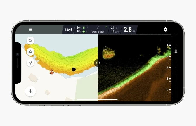
Sonar readout and export. See bottom composition and hardness, locate fish and underwater objects. Review your depth maps and sonar data via a mobile app or a web-app. Export raw bathymetric and sonar data.
For more than just fishing. Deeper sonars were created to locate good fishing spots. They were not designed for industrial/scientific surveying purposes, but still they have drawn interest from people and organizations of various vocations and now serve as a great tool for hydrographers, environmental scientists, universities, civil engineers, divers and many more.
Built-in GPS. Deeper sonars have built-in GPS (PRO+, PRO+ 2, CHIRP+, CHIRP+ 2) which allows bathymetric maps to be created while casting the sonar from shore or transporting it with a remote-controlled boat or drone. Sonar models without GPS can still create bathymetric maps from small watercraft (boat, kayak, pontoon, SUP board, etc.) utilising the GPS of your phone or tablet. You can also use your own GPS receiver for increased accuracy.
Light and easy to transport. No complex installation on a boat required. Deeper sonars are light and easily transportable. They can be quickly deployed, which can be very useful when you need to measure depth in multiple separate water bodies (e.g. brine pools) or conduct surveys in remote areas such as alpine/volcanic lakes.
Wireless, Simple Solution for Bathymetric Data
-
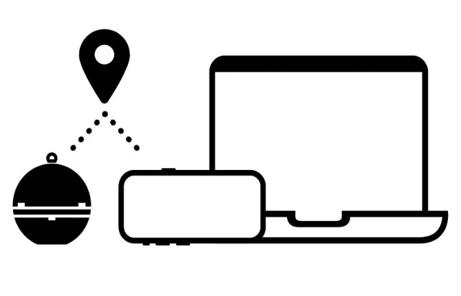
NMEA0183 data. Connect to the sonar (CHIRP+ 2, CHIRP+, PRO+ 2) with almost any device and receive the following NMEA messages over UDP: $GPGSA; $GLGSA; $GAGSA; $GNRMC; $GNVTG; $GPGSA; $GLGSA; $GAGSA; $GNRMC; $GNVT; $GNGGA; $SDDBT; $YXMTW.
Exportable data. Bathymetric data can be exported to a .CSV file containing the following values: latitude, longitude, depth, timestamp, water temperature. This data can be imported into other GIS software for 2D/3D map creation.
Raw sonar data can also be easily exported to a .CSV file. Exported file will contain a timestamp of each sonar ping and echo strength at each depth.
Wi-Fi connectivity. Deeper sonars use Wi-Fi to connect to a smartphone or tablet, allowing a wireless connection at ranges up to 100 - 120 m. Wi-Fi extenders can be used to increase it. Deeper creates its own Wi-Fi and can be used anywhere in the world.
Specifications
Deeper sonars can be great tools for bathymetric map creation and scientific research and surveying.
✓ 3 angle beams (47°/ 20°/ 7°)
✓ Casting range up to 100 - 120 m / 330 - 394 ft (depending on model)
✓ Depth range up to 100 m / 330 ft
✓ Operating time up to 8 - 15 hours (depending on model and usage conditions)
✓ Operating temperature from -20°C to 40°C / -4°F to 104°F
Experiences from the Field
-
Getting Better Sludge Maps
Philip Fandrick
Elemental Bioremediation Inc.
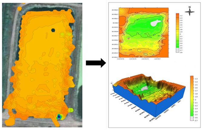
Situation: Creating bathymetric maps of small farm ponds as well as municipal reservoirs and even sewage lagoons.
"We started off by casting it just to get depth measurements. We then saw that we could do so much more with this little device. We have since fitted this device to a remote control boat and use it in boat mode with an iPhone on the RC boat. We use it to build full-on maps with it. This gives us better sludge maps on sewage lagoons than the old way of using a sludge judge throughout multiple locations on a lagoon. It is also safer since we need not send someone out on a boat on top of a sewage lagoon anymore."
"The raw data works great to input into CAD programs in order to produce some very nice maps."
-
Data for Treating Water Bodies
Devin Crosbie
FloridAquatic Inc.
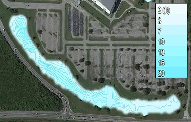
Situation: Maintaining lakes and storm water retention ponds for HOA communities, golf course, and government municipalities.
"We are just getting started using Deeper, and so far we’ve bathymetrically mapped about 8 lakes. The mapping is a new service we're offering to our clients. Outside of that, the Deeper PRO+ has been very useful in quickly casting out and gathering depth readings, which are then used to calculate the amount of chemical needed to treat certain water bodies."
"Very useful in quickly casting out and gathering depth readings."
-
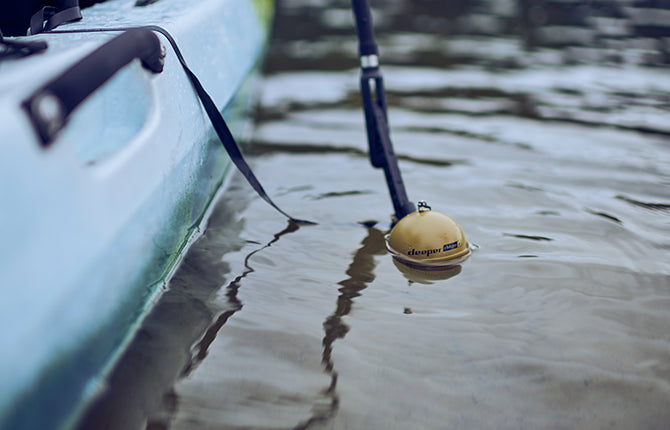
Verifying Water Depths
Curtis Weychert
North Carolina Department of Environmental Quality
Situation: Works for an environmental regulatory agency and needs to constantly verify water depths for development in the water.
"Not only do we use the Deeper to get specific areas of depth, but we use the bathymetric feature to identify things like deep water channels in shallow bays and sounds to aid in navigation decisions. We use the bathymetric feature to ensure that points of ingress and egress are not blocked, impacted, or otherwise unusable. Using tidal data from nearby buoys, along with using Deeper at low tides, we can interpolate the average depths relative to MLW or MLLW to ensure that the water depths at low tides wouldn’t cause impact to the bottom habitat through various kinds of development. The Deeper allows us to cast in various areas from shore and determine, through the bathymetric composite mapping, where the deepest waters and channels are."
"Product is accurate, easy to use, and affordable."
-
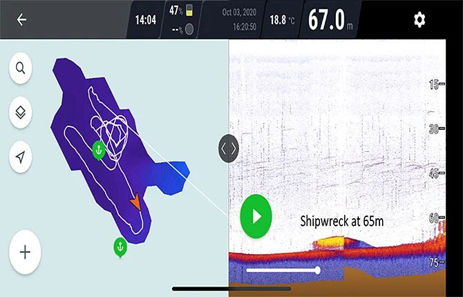
Finding Shipwrecks
Marc-André Dubois
DiverSituation: Using the Deeper CHIRP+ for shipwreck search in diving expeditions.
"There are not many accessible products for divers who want to find shipwrecks and we usually buy fishing side scanners or sonars as they are relatively precise. We really enjoyed the product. I was really impressed by the quality of the product, software and hardware. I tried much more expensive and bulky units and the CHIRP+ gives similar or even better results."
"Really impressed by the quality of the product, software and hardware."
-
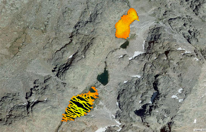
Reaching Very Remote Areas
Aquatic Ecologist
Situation: Researching alpine lakes.
"We use a very small boat (50 cm long) with the sonar floating in the centre of the boat (and the cellphone aboard) and move it with ropes from one shore to the opposite, so even we don't need to carry a big boat for us."
"We can access very remote lakes to get bathymetric data with a very light equipment and very good resolution."
Contact Us
Have questions or want to find out if Deeper Sonars are suitable for your purposes? Get in touch with us! We'll get back to you within 1 business day.


